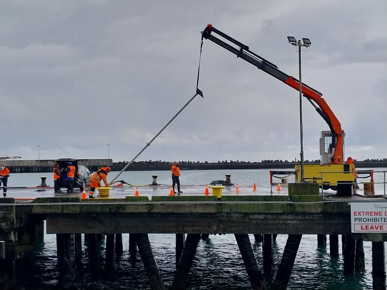
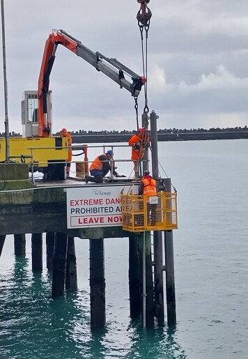
The stainless steel pole that houses the tsunami monitoring equipment is lifted and placed in the water and secured to Blyde Wharf.
Port Taranaki is now playing a key role in helping strengthen New Zealand’s ability to monitor and respond to tsunami threats and, ultimately, help protect the public.
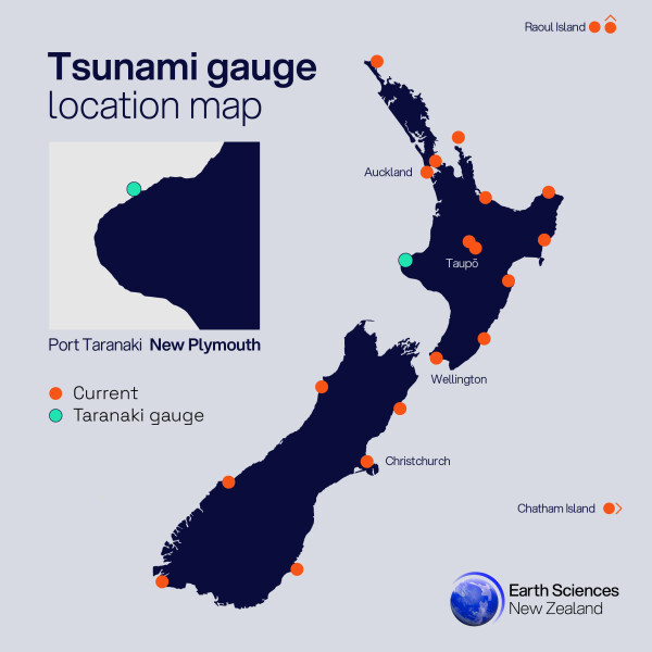
Earth Sciences New Zealand’s GeoNet programme has installed a new tsunami gauge at Port Taranaki, which fills a critical gap in coverage in New Zealand’s Tsunami Monitoring Network along the west coast of the North Island.
The gauge provides enhanced visibility of real-time and future tsunami risk in the region.
“This installation is a vital step toward improving our national resilience to tsunami hazards,” says Dr David Burbidge, tsunami scientist at Earth Sciences New Zealand.
“The west coast has fewer monitoring stations than other parts of the country, so this gauge gives us a clearer picture of what’s happening in real time and helps us better understand tsunami behaviour during and after an event. This site fills in an important part of our coastal tsunami gauge network – a vital tsunami monitoring dataset in tandem with our DART network and seismic monitoring capability, keeping eyes on the open ocean for tsunamis.”
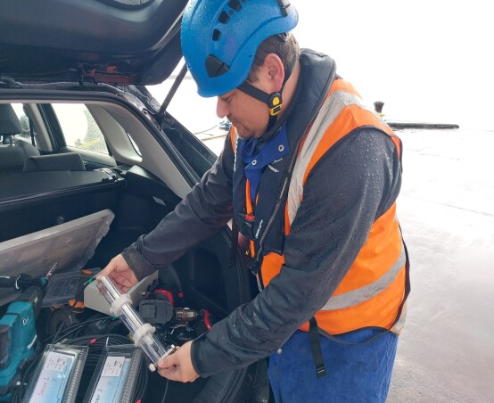
Earth Sciences New Zealand remote infrastructure technician Brendon Glendinning with the two pressure sensors that monitor the swell.
The gauge will serve two key functions:
- Monitoring: Delivering real-time data to assess current conditions and support emergency response and de-escalation.
- Post-event analysis: Providing detailed information on wave arrival times, amplitudes, and propagation to improve scientific models and forecasting.
“This isn’t just about collecting data, it’s about protecting people. Accurate, timely information can save lives and help communities recover faster after a tsunami,” Dr Burbidge says.
“To get the best data, we look for locations with deep water, simple seabed topography, easy access, and proximity to population centres or critical infrastructure,” Dr Burbidge explains. “Port Taranaki meets these criteria well, making it an ideal site for this installation.”
The installation builds on previous work at Port Taranaki, where a GNSS station was installed in 2024 as part of Toitū Te Whenua Land Information New Zealand’s 3D coastal mapping project.
Port Taranaki Chief Executive Simon Craddock says the port is more than happy to assist the tsunami monitoring programme and help safeguard the community and region.
As well as providing an area near the end of Blyde Wharf for the tsunami gauge componentry to be installed, Port Taranaki has also led the on-site project management, facilitating the site work around shipping movements.
“As a lifeline utility, Port Taranaki has a key role to play prior, during and post natural events, so having technology on-site that will help give our community vital information and contribute to time critical advice should a tsunami occur is invaluable,” he says.
“We’re also a west coast port, exposed to often challenging conditions, so we know the importance of monitoring and gathering information that helps develop our knowledge and understanding of weather, sea and swell activity.
“This is an important tool, and we look forward to working with Earth Sciences New Zealand as the monitoring proceeds.”
The recent Kamchatka (Russia) tsunami has made it clear how important these instruments are for providing critical data that informs how the country responds to tsunami events, and for keeping people safe and aware of what’s happening on their shores.
NEMA are the official source of tsunami warning information in New Zealand. For information on preparing for earthquakes or tsunami, there are guidelines from the National Emergency Management Agency's (NEMA) Get Ready website.
About the Taranaki tsunami station
The station includes:
- Two pressure sensors in protective housing.
- Armoured sensor cable run
- Data recorder
- 12V and 24V power supply systems
- Dual communication systems (cellular and Satellite)
- Large cabinet
Sensor installation:
- Structure-mounted: The sensor is fixed to existing marine infrastructure (e.g., wharves) with cabling protected by steel piping.
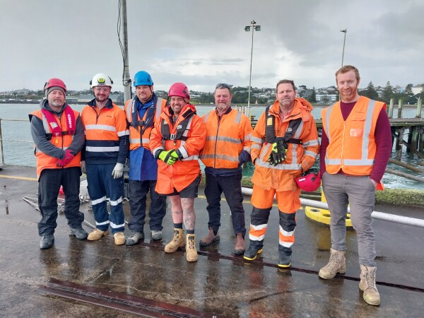
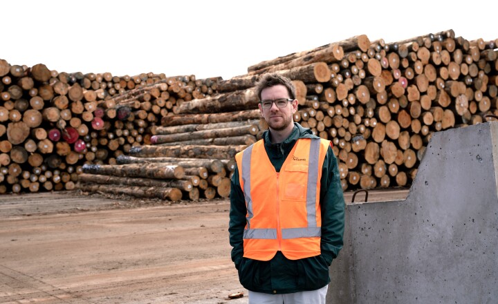
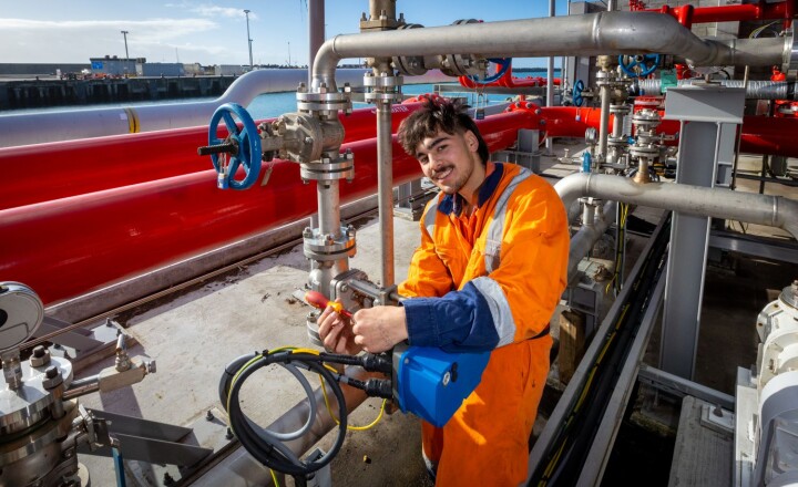
The Port Taranaki, Earth Sciences New Zealand, and JLE Electrical team that installed the tsunami gauge.